
Local Emergency Management Official Gives Update On Conditions Thursday Morning
The National Weather Service in Fort Worth has issued a winter storm warning and hazardous weather outlook until 6 p.m. Thursday, Feb. 24, 2022, for North and Central Texas.
Thursday, Feb. 24, 2022
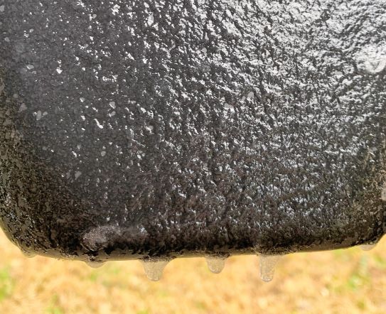
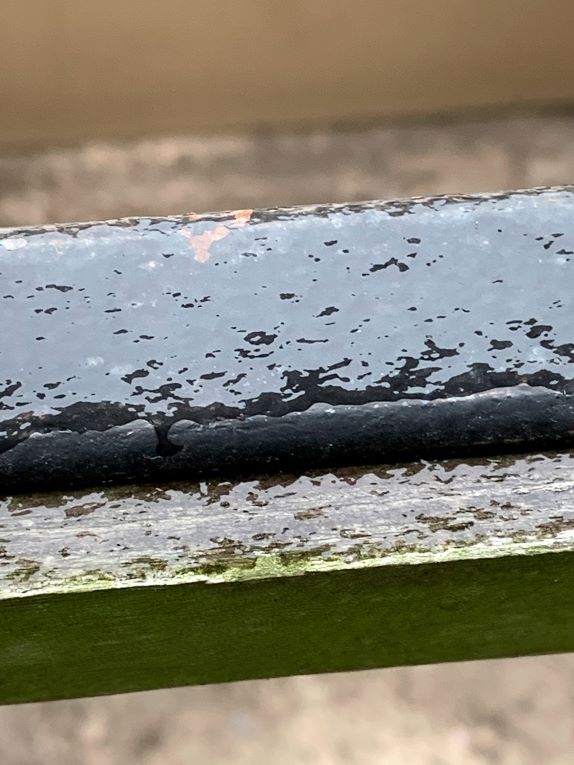
Today and tonight, freezing rain and freezing drizzle will continue across much of North and Central Texas, including portions of North Central and Northeast Texas from the Metroplex to the Red River and east along the I-20 corridor.
With temperatures well below freezing this morning, any accumulation will result in hazardous driving conditions. Isolated sleet showers will also be possible. New ice accumulations up to one-tenth of an inch. The precipitation will end from west to east during the afternoon.
A glaze of ice on area roads and bridges will make travel dangerous this morning. Travel impacts are expected to continue through midday.
The NWS recommends those who must travel to keep an extra flashlight, food, and water in their vehicles in case of an emergency. For the latest on Texas road conditions, visit drivetexas.org.
The Weather Service at 9:30 a.m. also said some should prepare for possible power outages due to the weather. According to the TXU Storm Center outage Map, 44 area power outages had been reported at 8:02 a.m. Feb. 24, 2022, impacting a total of 1,260 customers.
In the Hopkins county area, one power outage in the southern part of Sulphur Springs affected about 24 TXU customers, between I-30 and Wildcat Way, and SH 154 and Arbala Road was reported earlier this morning, but as of 8:02 a.m. Feb. 24 had been restored, according to the TXU outage map.
Friday through Wednesday
Sleet may occur in portions of Central Texas Friday morning. Little to no accumulation is expected. One final round of wintry weather will be possible Saturday morning. There is a chance of freezing rain, perhaps mixed with snow, mainly north and west of the Dallas/Fort Worth Metroplex. No significant impacts are anticipated.
Detailed NWS Forecast For Feb. 24-March 2, 2022
- Today
- Freezing rain before 3 p.m., then a chance of rain between 3 p.m. and 4 p.m. Some thunder is also possible. High near 34. Northwest wind 5 to 10 mph. Chance of precipitation is 90%. Total daytime ice accumulation of less than a 0.1 of an inch possible.
- Tonight
- Cloudy, then gradually becoming partly cloudy, with a low around 24. North wind 10 to 15 mph, with gusts as high as 20 mph.
- Friday
- Partly sunny, with a high near 46. North northeast wind 10 to 15 mph, with gusts as high as 20 mph.
- Friday Night
- A chance of rain and snow after 1 a.m. Mostly cloudy, with a low around 34. Northeast wind 5 to 10 mph. Chance of precipitation is 30%. Little or no snow accumulation expected.
- Saturday
- A chance of rain and snow before 7 a.m., then a chance of rain. Cloudy, with a high near 44. Northeast wind 10 to 15 mph. Chance of precipitation is 50%.
- Saturday Night
- A 50 percent chance of rain before 1am. Mostly cloudy, with a low around 32. North northeast wind 5 to 10 mph.
- Sunday
- Sunny, with a high near 57. North wind 5 to 10 mph.
- Sunday Night
- Mostly clear, with a low around 31. North northwest wind around 5 mph.
- Monday
- Sunny, with a high near 65. North wind 5 to 10 mph becoming south in the afternoon.
- Monday Night
- Mostly cloudy, with a low around 40.
- Tuesday
- Partly sunny, with a high near 69.
- Tuesday Night
- Partly cloudy, with a low around 42.
- Wednesday
- Sunny, with a high near 71.